
Pittsburgh Zoning Map - Addresses
By Carolyn Ristau

Introduction
Pittsburgh’s interactive zoning map includes many layers besides the zoning districts, most of which relate to requirements within or adjacent to the zoning code. For an overview on how to use the interactive zoning map, see our introductory post.
To select different layers, click the stack of paper in the upper right corner. The layers available are listed below. Today’s post features the Addresses layer, in bold text below.
Zoning
Zoning Districts
Zoning Districts Outlines
Zoning Max. Height Overlay
Height Reduction Zone Overlay
1500’ Major Transit Buffer
Parking Reduction Areas
North Side Commercial Parking Prohibited Area
Baum Centre Zoning Overlay
Inclusionary Housing Overlay District
RCO (Registered Community Organization) Areas
City Divisions
DPW Divisions
Neighborhoods
Council Districts 2012
Council Districts 2022 (Current)
Wards
Historic Preservation
Mexican War Street Historic Boundary
Individual City-Designated Properties
Pittsburgh City Historic Districts
Environment
RIV Riparian Buffer (125 Feet)
Stormwater Riparian Buffer
Floodplain Areas
Landslide Prone
Potential Steep Slopes Overlay Area
Undermined Areas
Addresses
Allegheny County
City Boundaries
Imagery 2021
The Addresses Layer
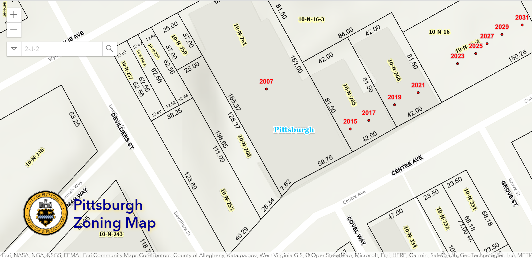
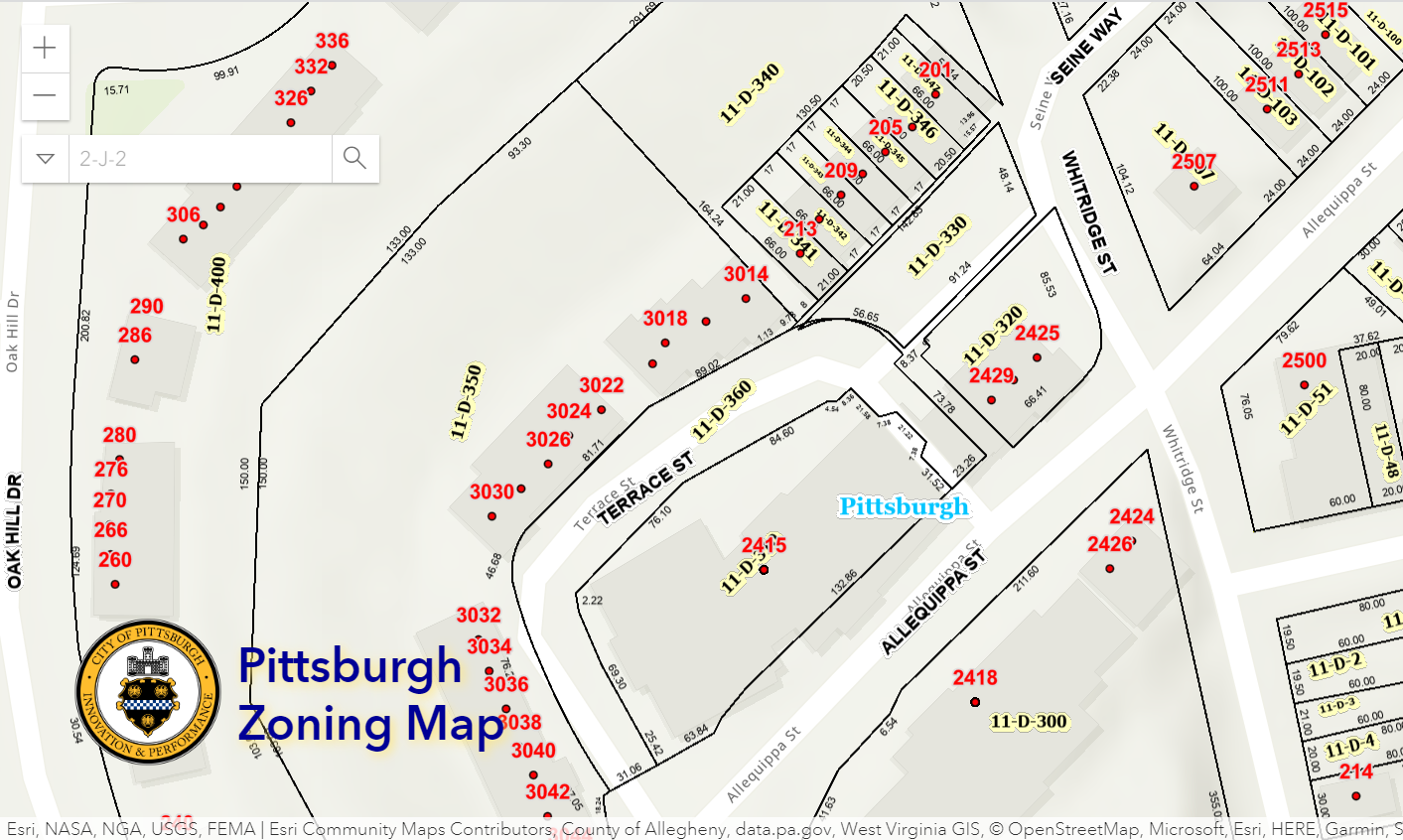
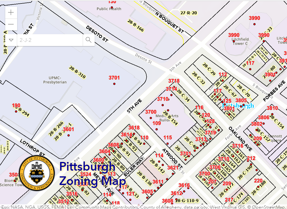
Overview
This layer of the interactive zoning map identifies the official address points within the City of Pittsburgh. It is not a clickable layer and it is only visible when zoomed into the parcel-level view. When in this view, this layer shows a point for every address with a number above indicating what the address is. If there is no point on a parcel, then it means that parcel currently does not have an official address. If there are multiple points on a parcel, then it means that parcel has multiple entrances for different uses or different units.
Relationship with Zoning
An official, city-recognized address is required for any permits or zoning approvals to be issued. This ensures that EMS are able to find the site in a timely manner in the case of emergency. There are several conditions that will likely be flagged during the zoning review and will hold up any final approval until the address or addresses are reviewed and assigned by the Addressing Committee. These conditions are:
a project on a parcel that has no address point
a project has multiple entries for different units or storefronts
the front door of the project does not align with the number of the existing address point
Challenges
This is an issue that takes many applicants by surprise. There is additional time, process, and documentation when a project needs to seek a verified or new address from the Addressing Committee.
Conclusion
The Addresses layer on the interactive zoning map can help identify if a project is likely to need to seek a verified or new address from the Addressing Committee. If so, additional time and documentation will be required.