
Pittsburgh Zoning Map - Intro
By Carolyn Ristau and Kathleen Oldrey
Introduction
Zoning regulations have two primary components: the code, or text, and the zoning map. The map shows which zoning district applies to each parcel within the local jurisdiction. Each zoning district has distinct rules for permitted uses, density, layout, and more. These rules are defined in the text. Asking what can be built or developed on a parcel without identifying the location and applicable zoning district is a futile effort.
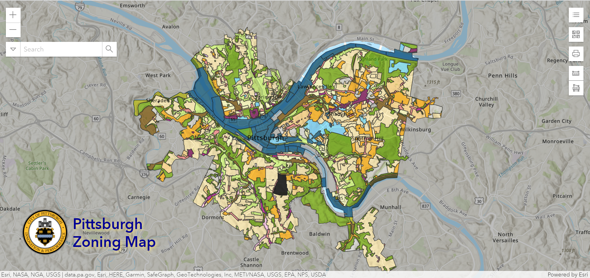
Most municipalities provide online access to their zoning map either as a static PDF or interactive GIS map. Pittsburgh provides an interactive map that includes many layers in addition to the zoning districts, many of which relate to requirements within the zoning code.
Today’s post provides a general overview of the interactive map’s features. Future posts will provide more information on the various layers available.
Map Features
Default View
There are three layers shown in the map’s default view:
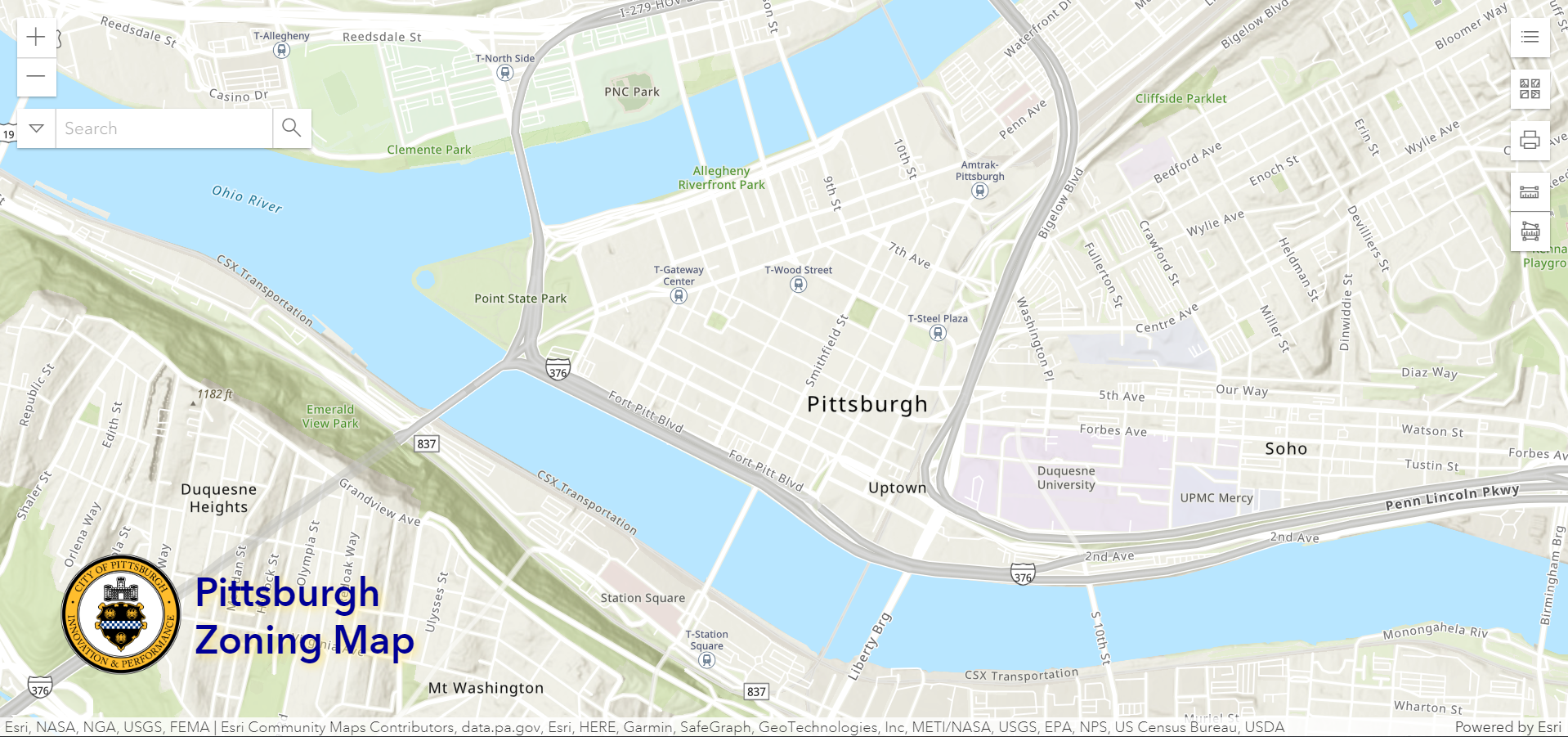
The Topographic Base Map - this shows the streets and waterways and a (frequently inaccurate) approximation of building footprints. No additional data is available from this layer.
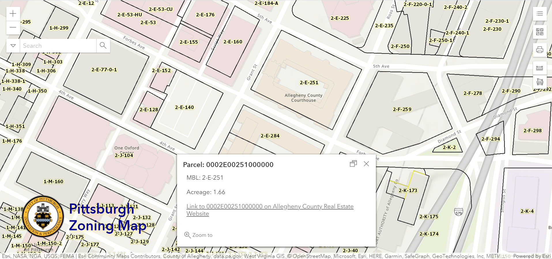
Allegheny County Parcels - this provides the parcel lines for all parcels in the county, a portion of which are in Pittsburgh. To access the Allegheny County real estate website data for a parcel:
Click within the boundaries of the parcel in question
Use the arrows to navigate between the pop-up windows as necessary
Select the “county real estate website” link
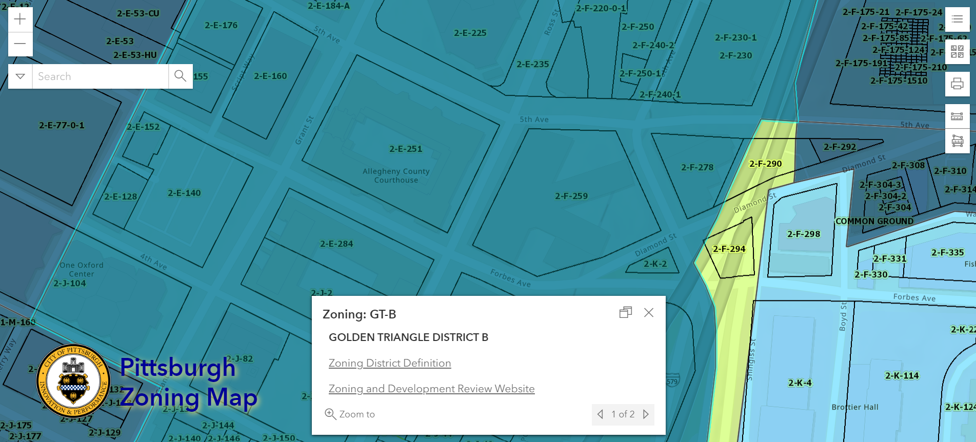
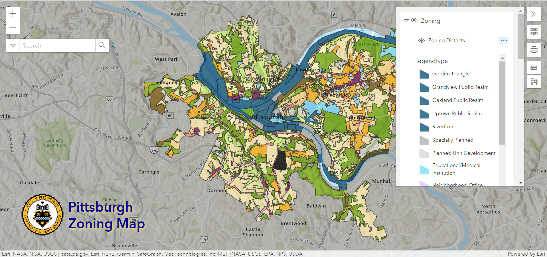
Zoning Districts - this shows the zoning districts for the entire City of Pittsburgh. To access the zoning code text for a zoning district:
Click within the boundaries of the district in question
Use the arrows to navigate between the pop-up windows as necessary
Select the “zoning district definition” link
Navigation Bar
Options in the upper left corner help users navigate the map:
Zoom
Search
default options include either:
Street address
Intersection
additional option:
click the carrot on the left and selecting “parcels”
enter the property Parcel ID or Lot & Block number (#-X-## format)
Toolbar
The toolbar in the upper right corner lets users adjust and work with the map by adjusting the layers visible, changing the underlying base map, printing, and measuring. Details on each of the tools are as follows:
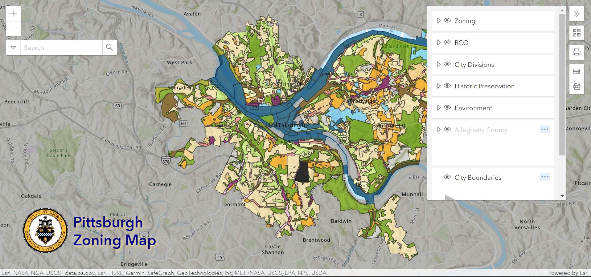
Layers Legend
The layers legend and selection tool are in the upper right corner. The layers available are listed below with the default layers in bold.
Zoning
City Divisions
Environment
Allegheny County (note: while these layers are on by default, they only appear once you zoom into the map)
Parcels
Lot Lines
Municipalities
City Boundaries
Imagery 2021
PAALLE010_OM (2021 Pictometry Mosaic)
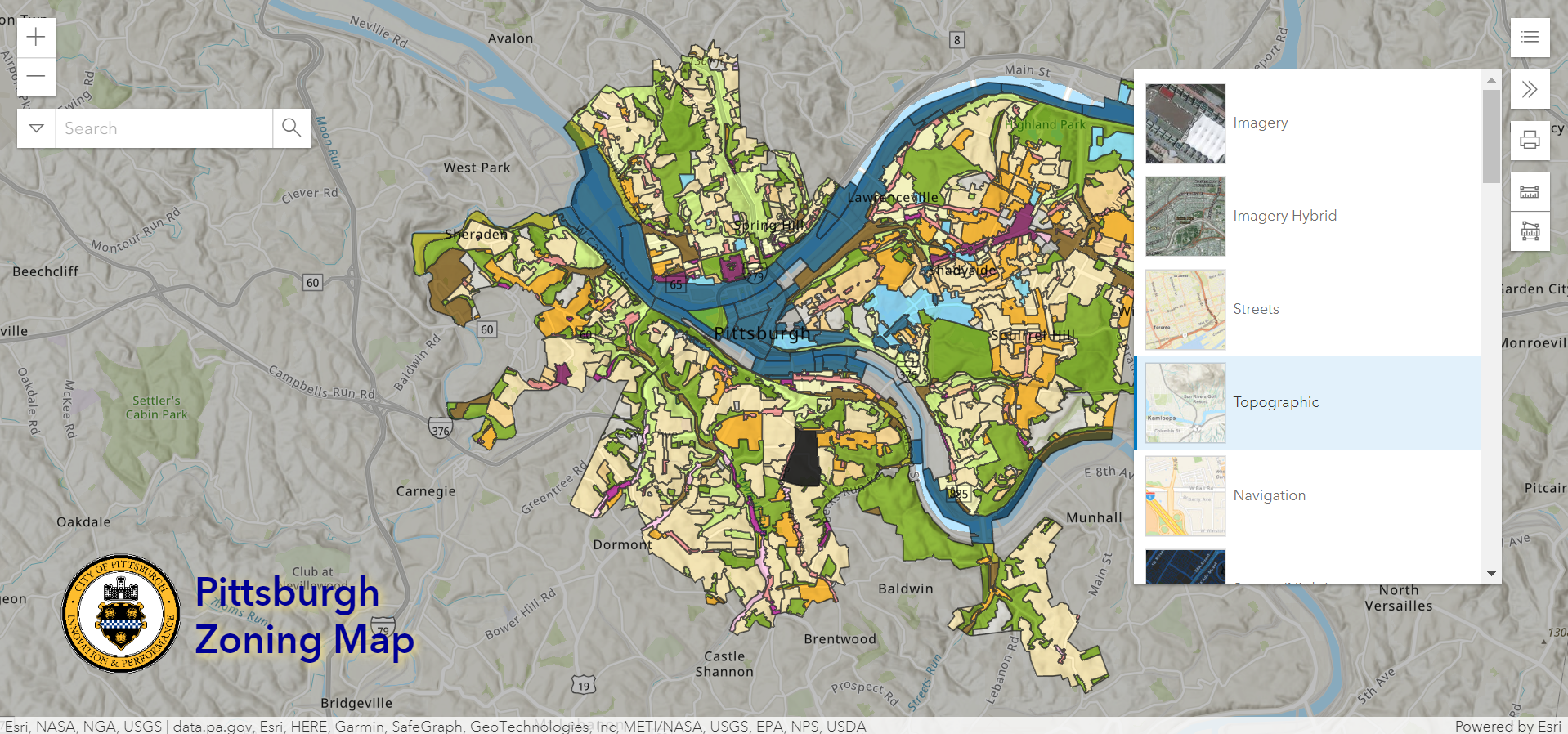
Base Map
The Base Map selection tool offers the following options for different styles of imagery underlying the selected map layers:
Imagery
Imagery Hybrid
Streets
Topographic
Navigation
Streets (Night)
Terrain with Labels
Light Gray Canvas
Dark Gray Canvas
Oceans
National Geographic Style Map
OpenStreetMap
Charted Territory Map
Community Map
Navigation (Dark Mode)
Newspaper Map
Human Geography Map
Human Geography Dark Map
Modern Antique Map
Mid-Century Map
Nova Map
Colored Pencil Map
Outline Map
Firefly Imagery Hybrid
NAIP Imagery Hybrid
USGS National Map
USA Topo Maps
OpenStreetMap (Blueprint)
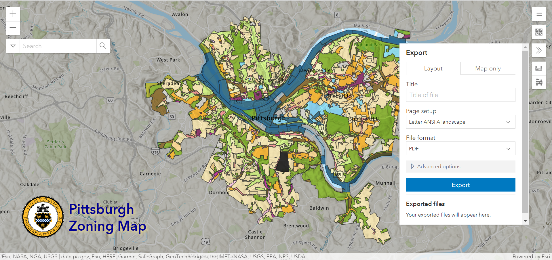
Print options include:
Portrait or landscape
Letter, tabloid, A3, and more
Measure
Measure options include:
Lines
Area
Challenges
As with any technological tool, Pittsburgh’s zoning map doesn’t always work perfectly. The most common issues are:
Searching for an address in Pittsburgh and winding up in another country, such as Brazil. Solutions include:
Check the spelling of the address
Add the ZIP Code
Loading issues where the map won’t load or it loads without any layers showing. This one is usually best solved by trying again later. The map is based upon data from three sources (ESRI ArcGIS, Allegheny County GIS, and Pittsburgh GIS). A glitch or update in either source can temporarily interrupt the map’s service.
Searching for an address in Pittsburgh, arriving at the correct location, but not seeing a zoning district. There are two possibilities:
Check that the zoning district layer is turned on
If it is turned on, then the location is not within the jurisdiction of the City of Pittsburgh (even if it has a Pittsburgh mailing address)
Missing layers. New or temporary layers or overlays introduced in the zoning code may experience a delay in appearing on the map or may never be added to the map. For example, the Accessory Dwelling Unit Overlay District pilot project was never added to the interactive map. Beyond closely following the legislative activity of the zoning office, there is no simple solution for finding this information prior to beginning the application process.
New Issues as of Spring 2022:
The search feature no longer seems to be able to search by parcel ID. This is an unfortunate change as it makes it impossible to search for properties without addresses. The work around is to manually zoom into the location or to find the address of a nearby parcel to search.
The pop-up boxes no longer point directly to the feature selected. Also, while the zoning district boundaries are highlighted when selected, the parcel outlines are no longer highlighted when selected. Users will need to do a visual check to confirm that the parcel ID in the pop-up box matches the parcel ID of the site in question. This is particularly important in areas like Lawrenceville where the parcels are small and close together, as the map often has a hard time distinguishing which parcel was clicked.
Conclusion
Start with Pittsburgh’s interactive zoning map to find the zoning district and zoning-related overlays for a particular site within the city limits.