
Residential Zoning by Race - Race and Zoning
by Carolyn Ristau
Comparing the factor of race with the locations of residential zoning districts in Pittsburgh, there is a strong correlation between Pittsburgh’s single-unit zoning districts and White neighborhoods and between the City’s multi-family zoning districts and Black neighborhoods.
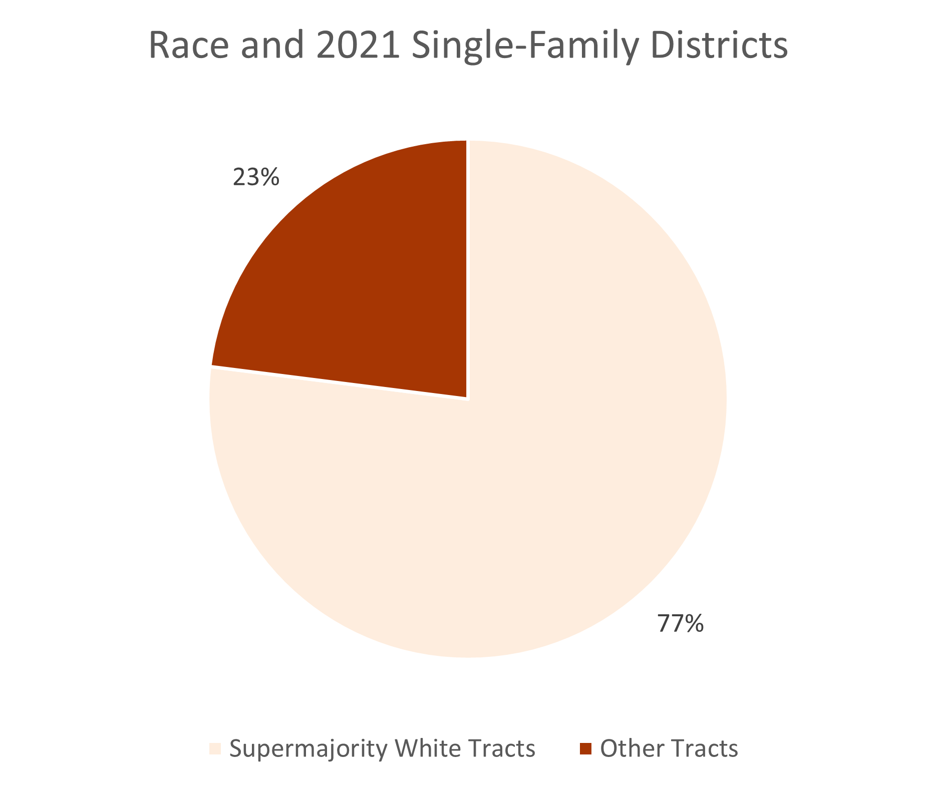
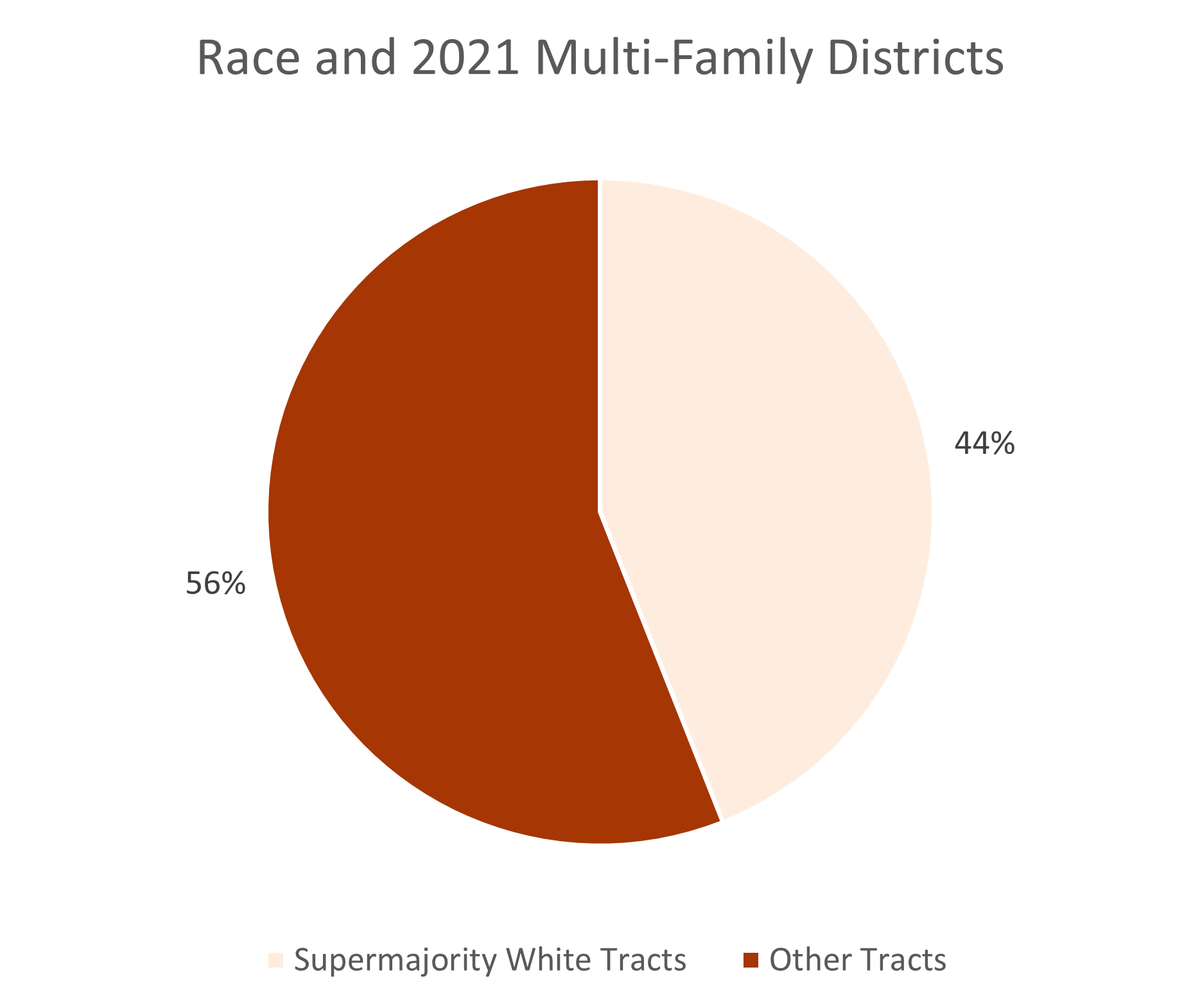
Overlaying the 2010 census demographics on the 2021 residential zoning districts in Pittsburgh, 77% of the current single-family zoning districts are located in areas with a supermajority of White residents, while only 44% of multi-family districts are in areas with a supermajority of White residents.
Both of these numbers have changed significantly over time.
Single-family zoning districts at first glance appear to have become more diverse in the 100 years of zoning. When they first appeared on the zoning map in 1927, they were 99% in areas with a supermajority of White residents. However, the trend line from 1927 to 2021 closely matches Pittsburgh’s overall increase in diversity, except that single-family zoning districts are more White than the city overall.
Multi-family zoning districts, on the other hand, have clearly become less diverse. At the same time as these districts lost ground in the city, exponentially decreasing in total land area, they have been increasingly located in non-White areas. Since 1961, the percentage of multi-family zoning districts in areas without a supermajority of White residents has tripled — from 18% to 56%.
These numbers indicate that race is a strong determinate for whether you live in a single-family zoning district or a multi-family zoning district in Pittsburgh,

More maps and graphs showing how the correlation between race and zoning over the last 100 years in Pittsburgh are available on the main project page.