
Pittsburgh Zoning Map - Council Districts 2022
By Carolyn Ristau

Introduction
Pittsburgh’s interactive zoning map includes many layers besides the zoning districts, most of which relate to requirements within or adjacent to the zoning code. For an overview on how to use the interactive zoning map, see our introductory post.
To select different layers, click the stack of paper in the upper right corner. The layers available are listed below. Today’s post features the Council Districts 2022 (Current) layer, pictured above and in bold text below.
Zoning
Zoning Districts
Zoning Districts Outlines
Zoning Max. Height Overlay
Height Reduction Zone Overlay
1500’ Major Transit Buffer
Parking Reduction Areas
North Side Commercial Parking Prohibited Area
Baum Centre Zoning Overlay
Inclusionary Housing Overlay District
RCO (Registered Community Organization) Areas
City Divisions
DPW Divisions
Neighborhoods
Council Districts 2012
Council District 2022 (Current)
Wards
Historic Preservation
Mexican War Street Historic Boundary
Individual City-Designated Properties
Pittsburgh City Historic Districts
Environment
RIV Riparian Buffer (125 Feet)
Stormwater Riparian Buffer
Floodplain Areas
Landslide Prone
Potential Steep Slopes Overlay Area
Undermined Areas
Addresses
Allegheny County
City Boundaries
Imagery 2021
The Council Districts 2022 Layer
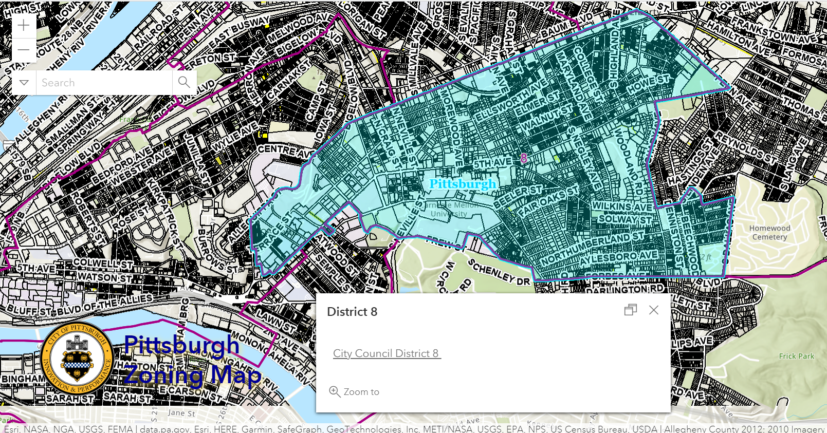
Overview
This layer of the interactive zoning map shows the city’s council districts as established in 2022 based on the 2020 census. To see which city council district a particular site is in as of 2022:
Click on the parcel in question
Use the arrows to navigate between the pop-up windows as necessary
Relationship with Zoning
Like the Neighborhoods layer, the Council Districts 2022 layer does not correspond to any specific regulations in the Zoning Code. However, the zoning office notifies the appropriate council office of projects on the Zoning Board of Adjustment or Planning Commission agendas. The council office may send a representative to observe and speak at projects of interest. It may benefit the project team to reach out to the councilperson’s office prior to a public hearing. In addition, the councilperson can often assist in facilitating conversations with the community.
Conclusion
The Council Districts 2022 layer of Pittsburgh’s interactive zoning map can be used to identify the appropriate city council office. Projects that will have a public hearing as part of the zoning process or that may be considered controversial may benefit from reaching out to the local councilperson to help arrange or facilitate a dialogue with the community.