
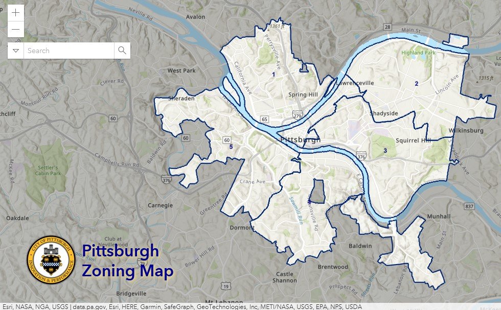
Pittsburgh Zoning Map - DPW Divisions
By Carolyn Ristau
Introduction
Pittsburgh’s interactive zoning map includes many layers besides the zoning districts, most of which relate to requirements within or adjacent to the zoning code. For an overview on how to use the interactive zoning map, see our introductory post.
To select different layers, click the stack of paper in the upper right corner. The layers available are listed below. Today’s post features the DPW Divisions layer, pictured above and in bold text below.
Zoning
Zoning Districts
Zoning Districts Outlines
Zoning Max. Height Overlay
Height Reduction Zone Overlay
1500’ Major Transit Buffer
Parking Reduction Areas
North Side Commercial Parking Prohibited Area
Baum Centre Zoning Overlay
Inclusionary Housing Overlay District
RCO (Registered Community Organization) Areas
City Divisions
DPW Divisions
Neighborhoods
Council Districts 2012
Council Districts 2022 (Current)
Wards
Historic Preservation
Mexican War Street Historic Boundary
Individual City-Designated Properties
Pittsburgh City Historic Districts
Environment
RIV Riparian Buffer (125 Feet)
Stormwater Riparian Buffer
Floodplain Areas
Landslide Prone
Potential Steep Slopes Overlay Area
Undermined Areas
Addresses
Allegheny County
City Boundaries
Imagery 2021
The DPW Divisions Layer
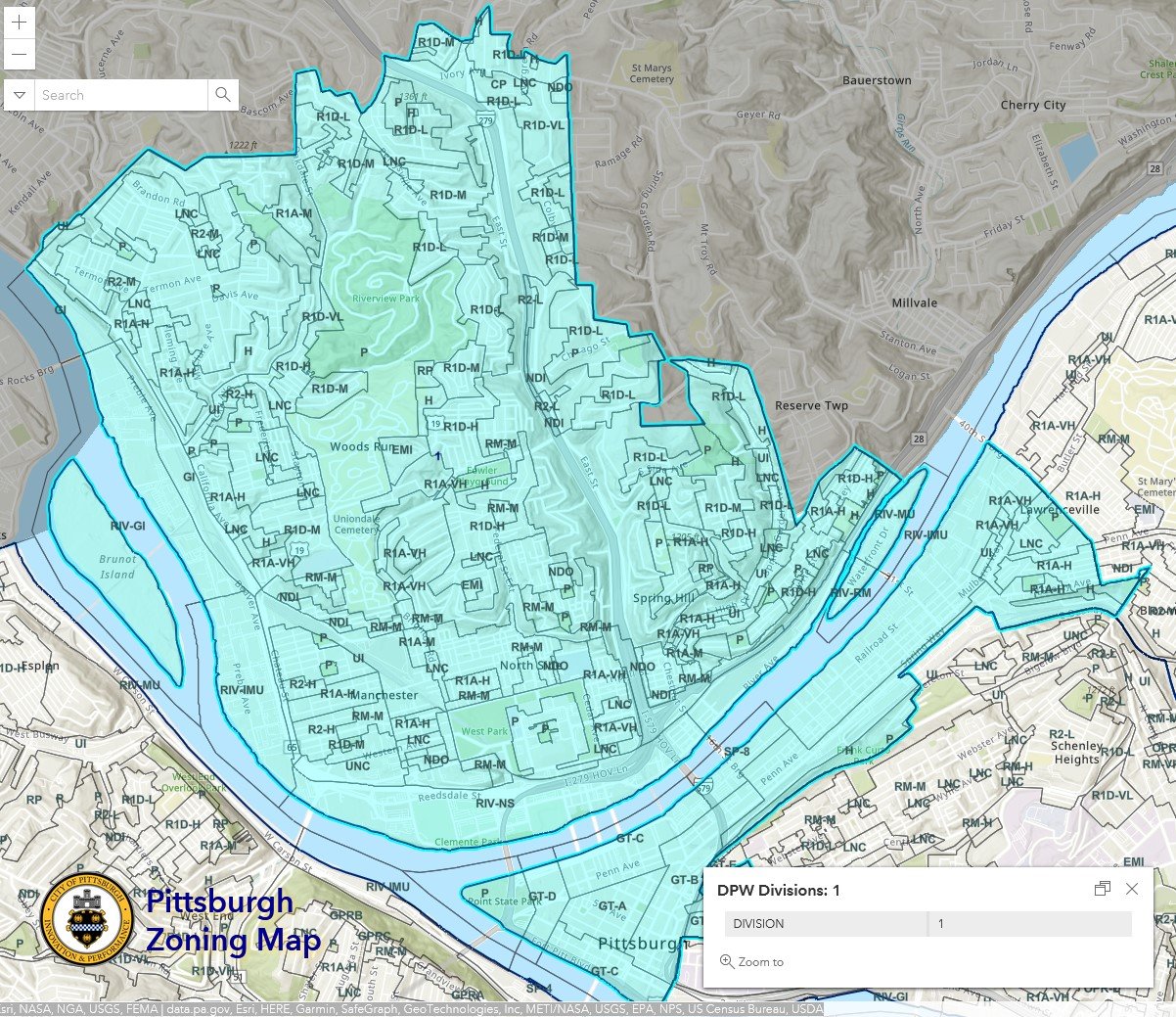
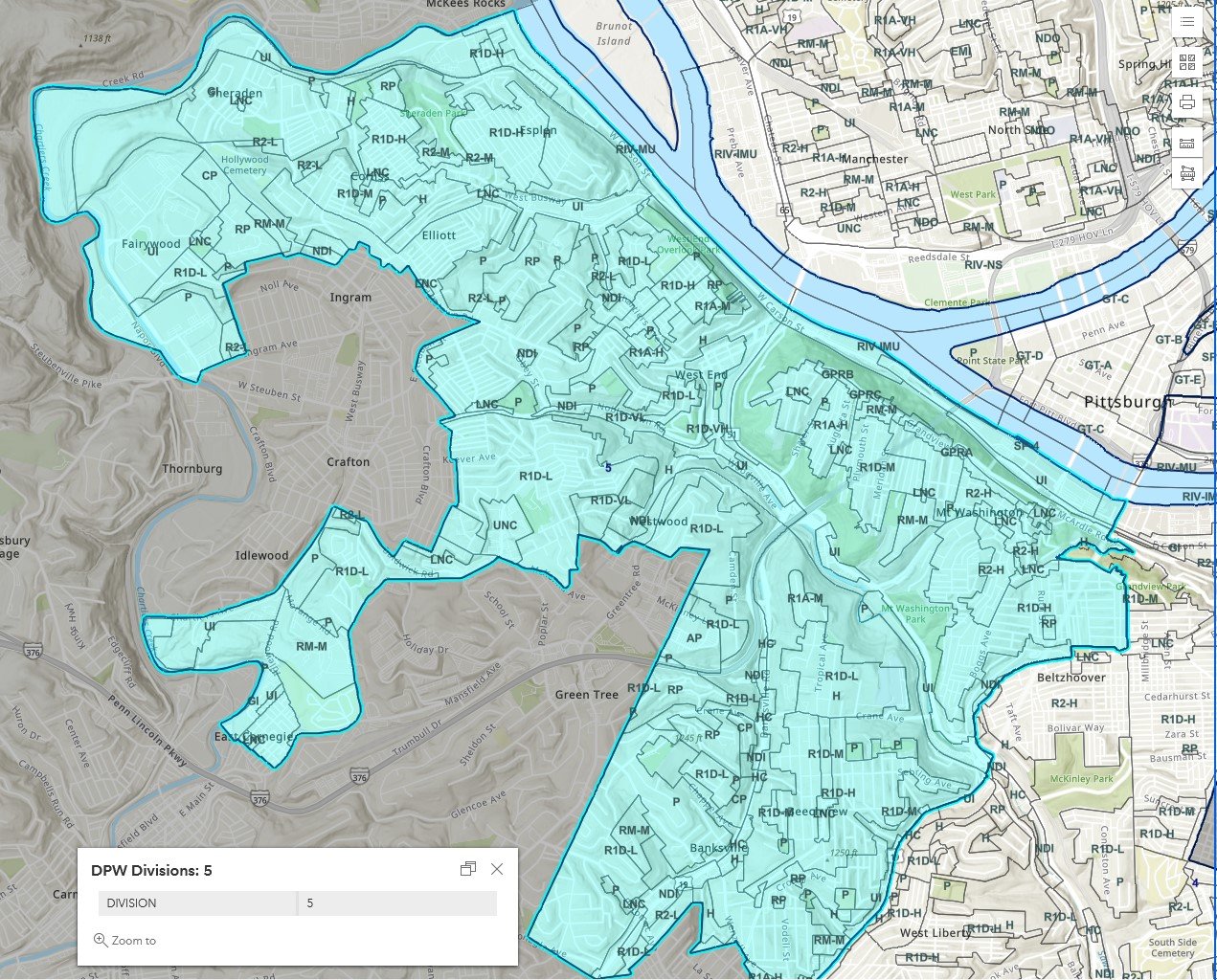
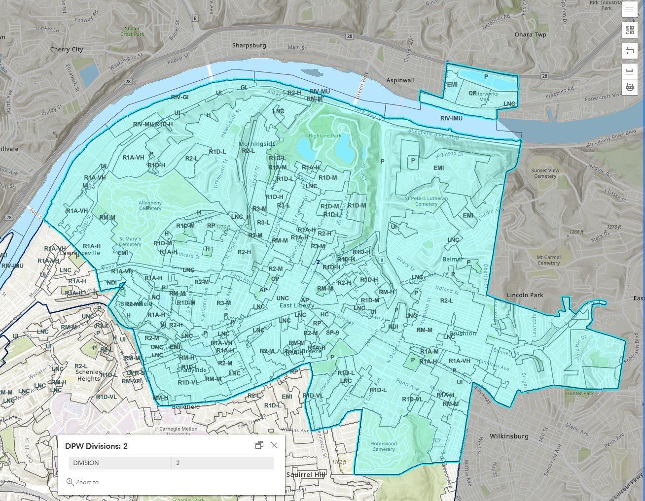
Overview
This layer of the interactive zoning map shows the divisions of the Department of Public Works (DPW). To see which DPW Division a particular site is in:
Click on the point in question
Use the arrows to navigate between the pop-up windows as necessary
Relationship with Zoning
The DPW Divisions are another layer that does not relate to specific Zoning Code regulations. Depending on the scope of work, some projects will require permits from DPW or the related Department of Mobility and Infrastructure (DOMI) or will work with DPW’s Forestry Division on the street tree requirements. However, the permitting divisions and Forestry Division are distinct from DPW’s Divisions 1-5. The numbered divisions may have a connection to the DPW permitting process that is not linked to the zoning process.
Conclusion
The DPW Division layer of Pittsburgh’s interactive zoning map is informational but does not relate to Zoning Code regulations or requirements.