
Pittsburgh Zoning Map - Stormwater Riparian Buffer
By Carolyn Ristau

Introduction
Pittsburgh’s interactive zoning map includes many layers besides the zoning districts, most of which relate to requirements within or adjacent to the zoning code. For an overview on how to use the interactive zoning map, see our introductory post.
To select different layers, click the stack of paper in the upper right corner. The layers available are listed below. Today’s post features the Stormwater Riparian Buffer layer, pictured above and in bold text below.
Zoning
Zoning Districts
Zoning Districts Outlines
Zoning Max. Height Overlay
Height Reduction Zone Overlay
1500’ Major Transit Buffer
Parking Reduction Areas
North Side Commercial Parking Prohibited Area
Baum Centre Zoning Overlay
Inclusionary Housing Overlay District
RCO (Registered Community Organization) Areas
City Divisions
DPW Divisions
Neighborhoods
Council Districts 2012
Council Districts 2022 (Current)
Wards
Historic Preservation
Mexican War Street Historic Boundary
Individual City-Designated Properties
Pittsburgh City Historic Districts
Environment
RIV Riparian Buffer (125 Feet)
Stormwater Riparian Buffer
Floodplain Areas
Landslide Prone
Potential Steep Slopes Overlay Area
Undermined Areas
Addresses
Allegheny County
City Boundaries
Imagery 2021
The Stormwater Riparian Buffer Layer
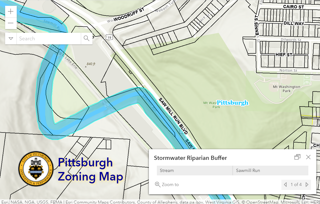
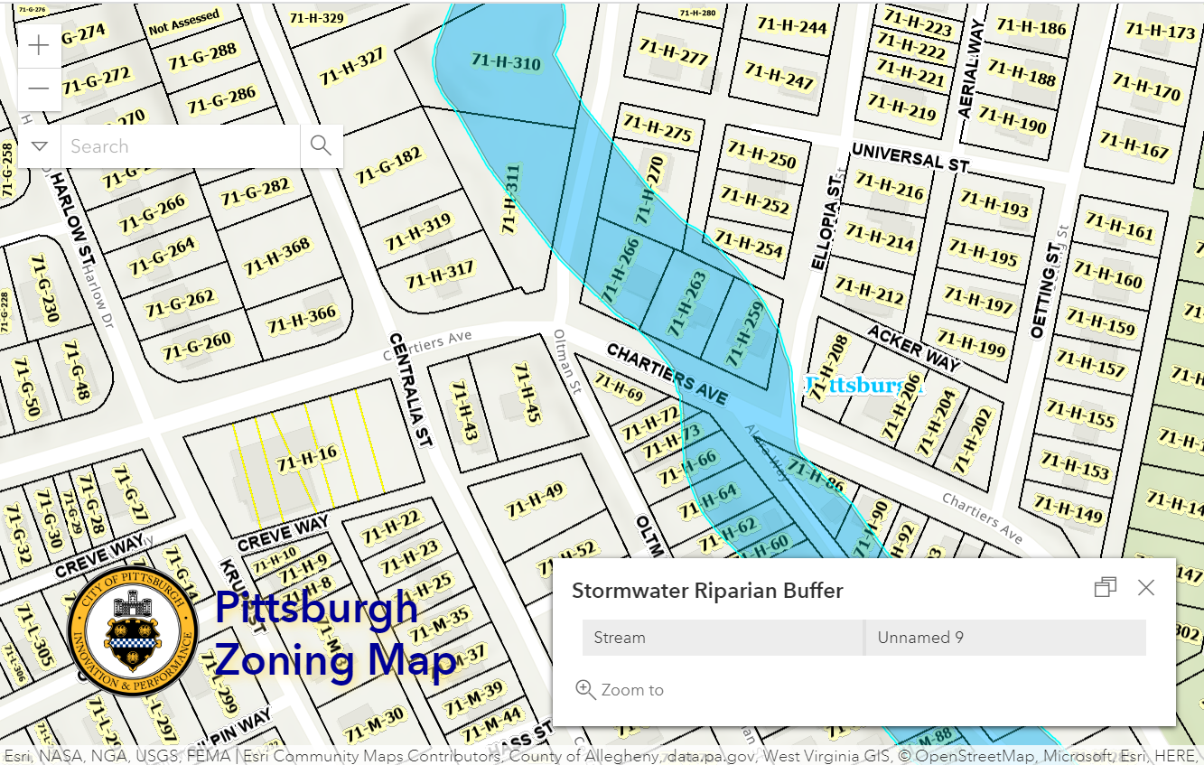
Overview
This layer of the interactive zoning map shows a buffer zone of along the edges of streams within the City of Pittsburgh. The stormwater buffer zone is not applied to the three rivers - the RIV Riparian Buffer is used instead .
To see whether a property includes area that is in the Stormwater Riparian Buffer:
Click the portion of the parcel in question that is covered with the riparian zone layer
Use the arrows to navigate between the pop-up windows as necessary
Relationship with Zoning
Stormwater regulations typically live outside the zoning code, but the applicability of these requirements to a project is often flagged during the zoning review. The Stormwater Riparian Buffer is provided as a guide to help applicants understand beforehand if they will need to follow the stormwater code’s Riparian Buffer requirements. The stormwater code is Title 13 of Pittsburgh’s city code; and the Riparian Buffer regulations are found in Section 1303.05.
Conclusion
Start with Pittsburgh’s interactive zoning map to check if your project is on a property that includes a Stormwater Riparian Buffer area. If it is, refer to the stormwater Riparian Buffer standards (Section 1303.05) to see what regulations will apply to the project.