
Pittsburgh Zoning Map - Height Reduction Zone
By Carolyn Ristau

Introduction
Pittsburgh’s interactive zoning map includes many layers besides the zoning districts, most of which relate to requirements within or adjacent to the zoning code. For an overview on how to use the interactive zoning map, see our introductory post.
To select different layers, click the stack of paper in the upper right corner. The layers available are listed below. Today’s post features the Height Reduction Zone Overlay, pictured above and in bold text below.
Zoning
Zoning Districts
Zoning Districts Outlines
Zoning Max. Height Overlay
Height Reduction Zone Overlay
1500’ Major Transit Buffer
Parking Reduction Areas
North Side Commercial Parking Prohibited Area
Baum Centre Zoning Overlay
Inclusionary Housing Overlay District
RCO (Registered Community Organization) Areas
City Divisions
DPW Divisions
Neighborhoods
Council Districts 2012
Council Districts 2022 (Current)
Wards
Historic Preservation
Mexican War Street Historic Boundary
Individual City-Designated Properties
Pittsburgh City Historic Districts
Environment
RIV Riparian Buffer (125 Feet)
Stormwater Riparian Buffer
Floodplain Areas
Landslide Prone
Potential Steep Slopes Overlay Area
Undermined Areas
Addresses
Allegheny County
City Boundaries
Imagery 2021
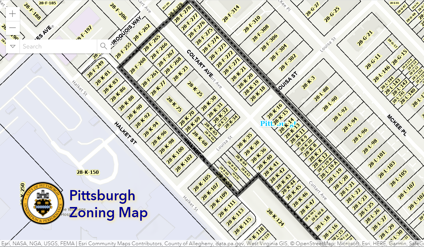
The Height Reduction Zone Overlay
Overview
This layer of the interactive zoning map shows where the maximum height is reduced from the zoning district’s standard maximum height. This layer is currently depicted as lines and is therefore not clickable. Also, not all of the lines connect, so it is not clear how to tell if a property is affected by this overlay. Our assumption is that if a property is in the UC-MC, UC-E, or R-MU and it borders one of these lines, it may be subject to this overlay.
Relationship with Zoning
Most of Pittsburgh’s zoning districts include a maximum height requirement that is consistent throughout the district. The newest zoning districts are taking a different approach that creates subdistricts of height within the primary district or use-based subdistrict. In some situations, the maximum height may be increased according to the Zoning Max Height layer of the interactive map. The UC-E (Urban Center Employment), UC-MU (Urban Center Mixed Use), and R-MU (Residential Mixed Use) zoning districts are taking this a step further and have created an overlay where the maximum permitted height is partially reduced for all properties within the Height Reduction Zone Overlay.
Per Section 922.15.K: Where identified in Height map, the height reduction zone restricts building height for twenty (20) feet into the development parcel. Structures or portions of structures in this zone may not exceed the maximum height permitted in the adjacent zoning district plus twenty (20) feet. The height reduction zone is not a setback, it restricts height within the first twenty (20) feet as shown on the adopted height map.
In other words, for properties along the Height Reduction Zone Overlay, the height is limited within the first 20 feet of the property to no more than 20 feet higher than the max permitted in the adjacent zoning district.
For example, a property in the UC-MU across the street from a property in the R1A-VH is limited to 60 feet in height for the first 20 feet of property. (60 = 40-foot height limit of the R1A-VH + 20 feet.) Beyond that first 20 feet of property, the maximum height is as otherwise permitted in the UC-MU according to the Zoning Max Height layer.
Challenges
This layer is not clickable, which means it is harder to identify if a property is impacted by it. The only way to tell is to navigate to the property in question and see if it is bordered on any side by the line of this layer. It will be easiest to do with the zoning districts layer on. As even when a property is bordered by the overlay, the zoning district of the property determines whether the height limitation applies and the zoning district of the property on the other side of the line determines what that limitation is.
Because of the formulas involved in determining the height limitations of this layer, some extra flipping through the zoning code is required to get all the information needed for the formula.
Conclusion
The Zoning Max Height layer is a key starting point for determining the maximum height permitted for a project in the UC-E, UC-MU, and R-MU zoning districts, but the Height Reduction Zone Overlay is also important to determine if there are any limitations to the maximum permitted height. Start with Pittsburgh’s interactive zoning map to check the maximum permitted height where the project is located and to verify if the property is along the Height Reduction Zone Overlay. Then, check the adjacent zoning district’s height standards to help determine what the height limitations are.