Residential Zoning by Race:
How Pittsburgh’s Zoning Districts Promote Different Housing Options for Black and White Residents
Part 4: Case Study Context
by Carolyn Ristau
A Closer Look
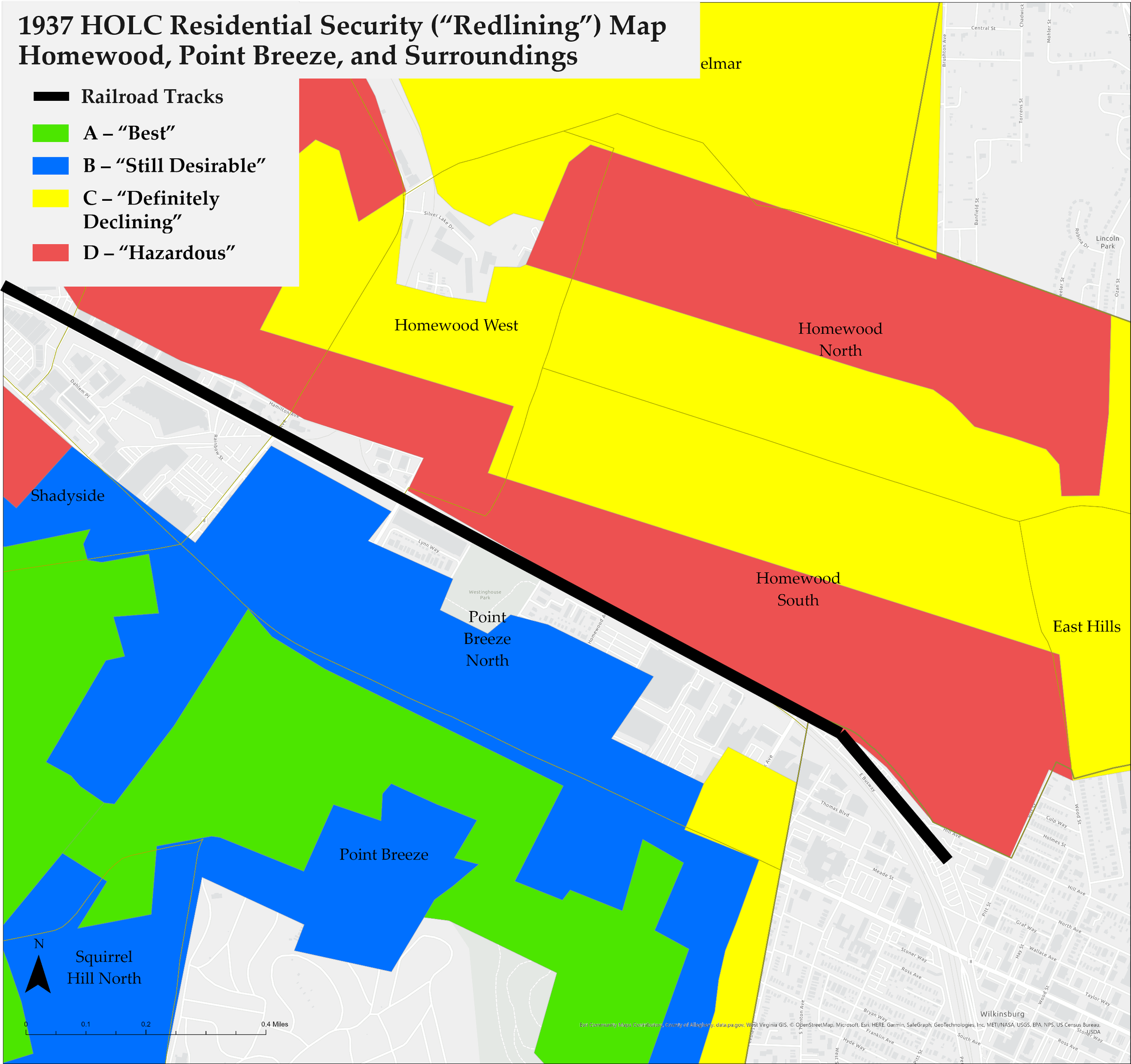
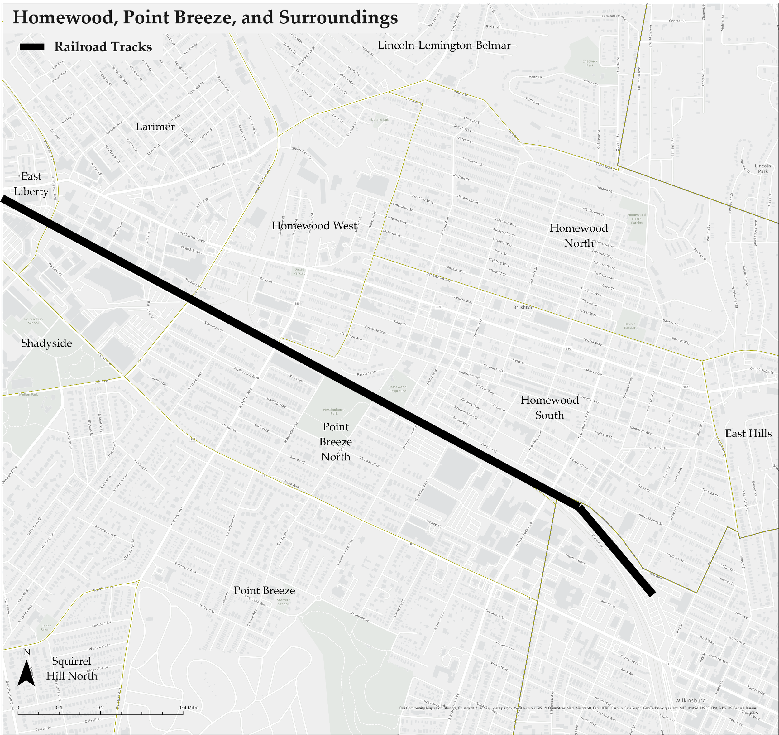
We will periodically zoom into the Homewood and Point Breeze neighborhoods of Pittsburgh. The arrow in the city-wide map points to the boundary between these neighborhoods which epitomizes the phrase “the wrong side of the tracks.” The Homewood neighborhoods designated by the City as Homewood West, Homewood North, and Homewood South are on the north side of a substantial railroad line and busway. Point Breeze and Point Breeze North are on the south side of this barrier.
The differences between these neighborhoods are illustrative of the different factors that were previously discussed as influencing the location of single-family versus multi-family zoning districts.

Factor 1: Existing Built Environment
The Homewood neighborhoods are predominately zoned with multi-unit districts, but when driving or walking around these neighborhoods, the pre-1950 housing stock is predominately detached single-family dwellings (Figure 1).
Immediately across the railroad tracks, North Point Breeze is almost entirely in a single-family zoning district. However, the pre-1950 housing stock includes a significant number of three-story apartment buildings and duplexes (Figure 2).
The contradictions in both areas between the existing built environment and the current zoning districts show that the existing built environment carried little to no weight in determining the location of these single-family and multi-family zoning districts.


Figure 2: Apartments in Point Breeze North
Figure 1: Single-Family Homes in Homewood
Factor 2: Proximity to Other Uses
In the city-wide map of multi-family zoning districts on the previous page, the clusters of districts with a high student population are an example of zoning that is likely influenced by proximity to other uses. The two largest universities in the city plus two smaller universities are adjacent to these clusters.
When looking at the Homewood and Point Breeze neighborhoods, proximity to other uses is another potential factor that doesn’t appear to have significant weight with the current location of the zoning districts. Both areas are similarly situated next to industrial areas—the brown UI districts on the map—and a similar distance from the East Liberty neighborhood’s commercial core. In the latter situation, Point Breeze has a slight advantage as Penn Avenue, the main artery through East Liberty, is the dividing line between Point Breeze North and Point Breeze.
Based on the existing built environment analysis above, 75-100 years ago, when East Liberty was considered Pittsburgh’s second downtown, Point Breeze’s edge in proximity to this area may have been reflected in the denser housing located there. However, it is not reflected in the current zoning districts.

Factor 3: Transportation Options
In the 1970s, the number of tracks needed by the railroad had diminished and about half of the lines were converted to a busway. While the remaining tracks are on the Homewood side, both Homewood and Point Breeze have access to the same stations along this busway. In addition, there are buses on the roads through both areas, including a line for each neighborhood that connects to the universities and downtown.
As the options for transportation are substantially similar between these areas, this factor again does not explain the difference between the zoning districts in Homewood versus Point Breeze.
Factor 4: Future Land Use Goals
As the three factors discussed above do not appear to have had significant weight in determining the location of the single-family and multi-family zoning districts, future land use goals seem to be the most likely factor of the four commonly discussed factors. However, as the City of Pittsburgh has never adopted a comprehensive plan, there is no easy reference to understand the future land use goals for any area of the city at any point in the 100 years of zoning. As a result, this project looks for other factors to help explain the location of the single-family and multi-family districts in the city.
Other Factors
Exploring the Home Owner’s Loan Corporation’s Residential Security Map—aka “redlining” map—for the neighborhoods of Homewood and Point Breeze suggests that the redlining map may be a determinant of the location of multi-family versus single-family zoning districts in Pittsburgh. As mentioned in the previous section, race is another factor that appears to play into the location of these districts.
The following sections will explore the correlations between the redlining and race factors and the locations of single-family and multi-family zoning districts in 1927, 1967, and 2021.